G GeoAngelo Full Member Joined Feb 20, 2023 Messages 224 Location Long Island and Hudson Valley Apr 22, 2024 #1 Hi all. Anyone have a good interactive LIDAR tool for New Jersey? I have for NY, CT and Mass that I can share for anyone interested. Thanks!
Hi all. Anyone have a good interactive LIDAR tool for New Jersey? I have for NY, CT and Mass that I can share for anyone interested. Thanks!
cellrdwellr Elite Member Joined Jul 20, 2014 Messages 19,321 Location Dirt Cellar, MA Apr 23, 2024 #2 Looks like they are either: A) getting fake spray tans or B) at the gym
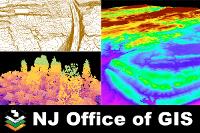
cellrdwellr Elite Member Joined Jul 20, 2014 Messages 19,321 Location Dirt Cellar, MA Apr 23, 2024 #3 This might be it? New Jersey NJGIN Elevation Products (LiDAR) This online document was created to provide a link to all elevation products available via the New Jersey Geographic Information Network (NJGIN) website. For a complete please list visit https://njgin.nj.gov/njgin/edata/elevation njogis-newjersey.opendata.arcgis.com
This might be it? New Jersey NJGIN Elevation Products (LiDAR) This online document was created to provide a link to all elevation products available via the New Jersey Geographic Information Network (NJGIN) website. For a complete please list visit https://njgin.nj.gov/njgin/edata/elevation njogis-newjersey.opendata.arcgis.com
keithdetects New Member Joined Aug 29, 2022 Messages 6 Location Plainfield, NJ Apr 23, 2024 #4 I use the NJ 10 foot Hillshade map here: https://newjersey.maps.arcgis.com/home/item.html?id=c933f6f768fc493d9761fd7911a2d98f#overview
I use the NJ 10 foot Hillshade map here: https://newjersey.maps.arcgis.com/home/item.html?id=c933f6f768fc493d9761fd7911a2d98f#overview
G GeoAngelo Full Member Joined Feb 20, 2023 Messages 224 Location Long Island and Hudson Valley Apr 24, 2024 #5 keithdetects said: I use the NJ 10 foot Hillshade map here: https://newjersey.maps.arcgis.com/home/item.html?id=c933f6f768fc493d9761fd7911a2d98f#overview Click to expand... Yes, thank you. I've seen that one but was hoping there was something more high-res available. Appreciate the reply!
keithdetects said: I use the NJ 10 foot Hillshade map here: https://newjersey.maps.arcgis.com/home/item.html?id=c933f6f768fc493d9761fd7911a2d98f#overview Click to expand... Yes, thank you. I've seen that one but was hoping there was something more high-res available. Appreciate the reply!