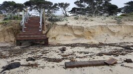
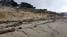
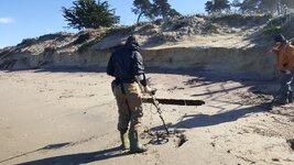
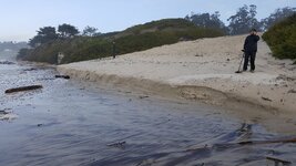
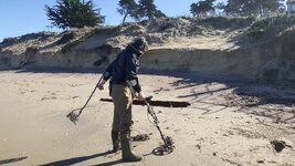
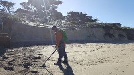
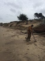
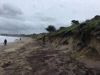
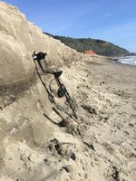
Some very impressive cuts Tom....So do Finds that were lost further towards the low tide line get thrown back up along the cut by storm/wave action?...
You're asking (if I understood you correctly) about coins that "come back in" , during the summer beach build-up ? Yes It is presumed that targets come back "in". We're not really tracking that . Since the summer sand buildup takes all summer long, 1 inch at a time, to build back up the beach. Either during the slow buildup, or perhaps "thrown back up" during storms ? Ie.: One storm seems to "build the beach", while the next storm seems to "erode" the beach".
I have no idea about your question of finds that were/are "back up". Because if we arrive at a beach (during our reconn. samplings) to find that it's built "up", we know it will be no good. There's no rhyme or reason to target placement, that I know of, to that (insofar as when targets that "came back in/up).
Instead what we are looking for is targets that had ALREADY been in the sand . Ie.: Those sand dunes , with the ice plant, that you see in the pix. And we are looking to see where the targets are in relation to the inter-tidal zone below those cuts. Typically at the foot of the cut. To perhaps the first 10 or 20 ft. out. But I've seen erosion episodes where the target beds (where the targets "came to rest") can be all the way at the water's edge.
And I've even seen rare conditions where : All the lightweight stuff (zinc pennies, etc...) are at one parallel. Then you go a bit further down and it's your heavier coins (dimes and copper pennies). Then you go a little further down, and it's now the heavier coins (quarters). And alas, at the water's edge is fishing sinkers and gold rings.

Now as to whether this ^ ^ meant that we're getting targets that were "coming back in " vs "going out", I don't know. We just know the look of the beach (the lay-of-the-land) that bodes goodies. And it's either : 1) Cuts (as you see in the pix), or 2) Scallops (indents that resemble giant inverted scallop shell formation), or 3) Steep slope. Ie.: more sloped than is normal for the particular beach.
........ Also what's the typical distance between your high and low tide points?
The biggest swings (called "king tides") have about an 8 ft. spread. That would be a high of perhaps positive 6.5 ft, and a low of negative 1.5 -ish . Which, as you can see, is an 8 ft. difference. At least in my part of CA.